Skills and Experience

image028
Montane and moorland habitats near golden eagle eyrie, Argyll

They also conduct ecological reviews of rare species and have published research on anadromous fishes in European waters. Their fieldwork has led to notable discoveries, including a new population of the legally protected Irish St John’s Wort in 2024. Additional services include Environmental Impact Assessments, ECoW, fisheries assessments, and ornithological studies.

Max is a Chartered Environmentalist and full member of the Chartered Institute of Ecology and Environmental Management (CIEEM), holding several protected species licences and accreditation as a European Seabirds at Sea surveyor. Siân brings expertise in water quality regulation, GIS analysis, and mapping.

Max and Siân hold degrees in Biology, Marine Biology and Applied Hydrobiology, and run a highly skilled consultancy based in south-west Scotland. They specialise in surveying and assessing the condition and conservation value of marine biotopes and terrestrial habitats across Scotland, England, Wales and Ireland, working for commercial clients, governmental nature conservation agencies and environmental charities. 
 
Their skills and experience allow them to undertake work ranging from national research projects to establishing the ecological functioning of habitats and developing site-specific restoration plans for individual SSSIs and SACs. They frequently collaborate with governmental conservation agencies on the ecology and conservation of highly complex habitats including groundwater dependent terrestrial ecosystems, rivers, peatlands and seagrass beds. 

image008
Crimson waxcaps, Hygrocybe punicea, in old, unimproved pasture, Scottish Borders

HaBITAT SURVEYS

1

Max and Siân have conducted marine and terrestrial habitat surveys throughout the UK and Ireland. Their familiarity with thousands of north-west European species and hundreds of habitats underpins their ecological assessments.

image012
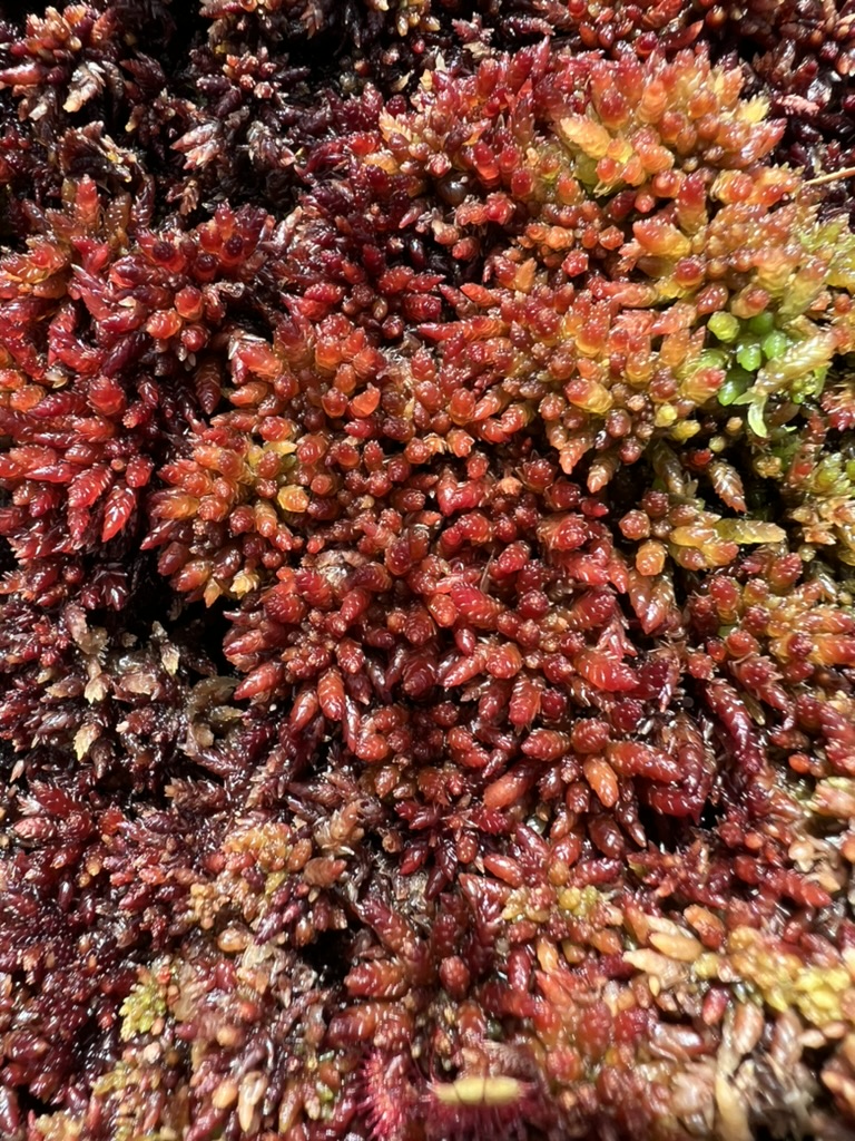
Sphagnum medium, Co.Mayo, Ireland

Oceanography

2

They have studied coastal processes across all 11 Scottish Marine Regions for NatureScot, and have in-depth knowledge of British and Irish coastal hydrodynamics.

image004
Kelp forest, Firth of Forth

Bespoke Surveying Techniques

3

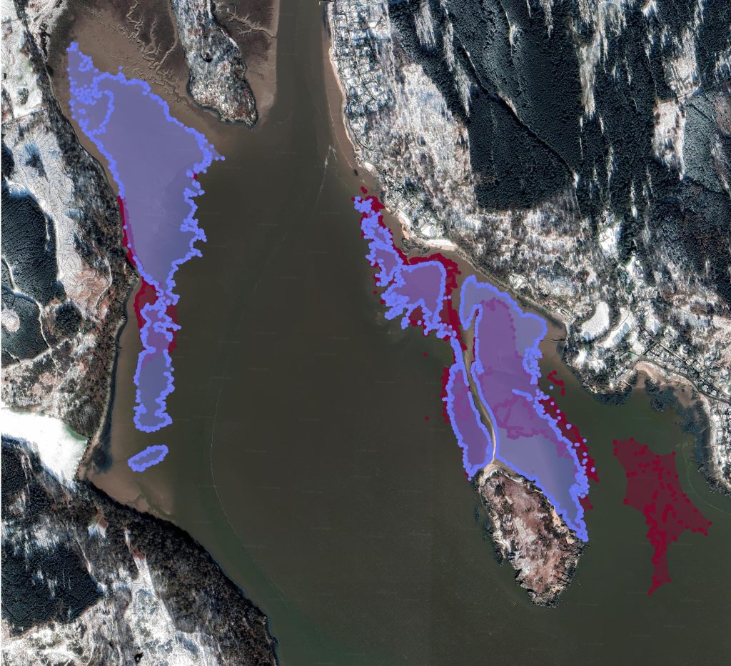
Over the course of numerous surveys, Max and Siân have developed bespoke survey techniques for precise habitat mapping, allowing, for example, thousands of individual GPS points to be collected on one tide. They have used these techniques for mapping upland base-rich flushes and seagrass beds.

Seagrass beds in Rough Firth, in the Solway Firth. Zostera marina in red and Zostera noltii in lilac. Google imagery ©2024 CNES / Airbus, Getmapping plc, Landsat / Copernicus, Maxar Technologies, Map data ©2024

LiDAR Analysis

4

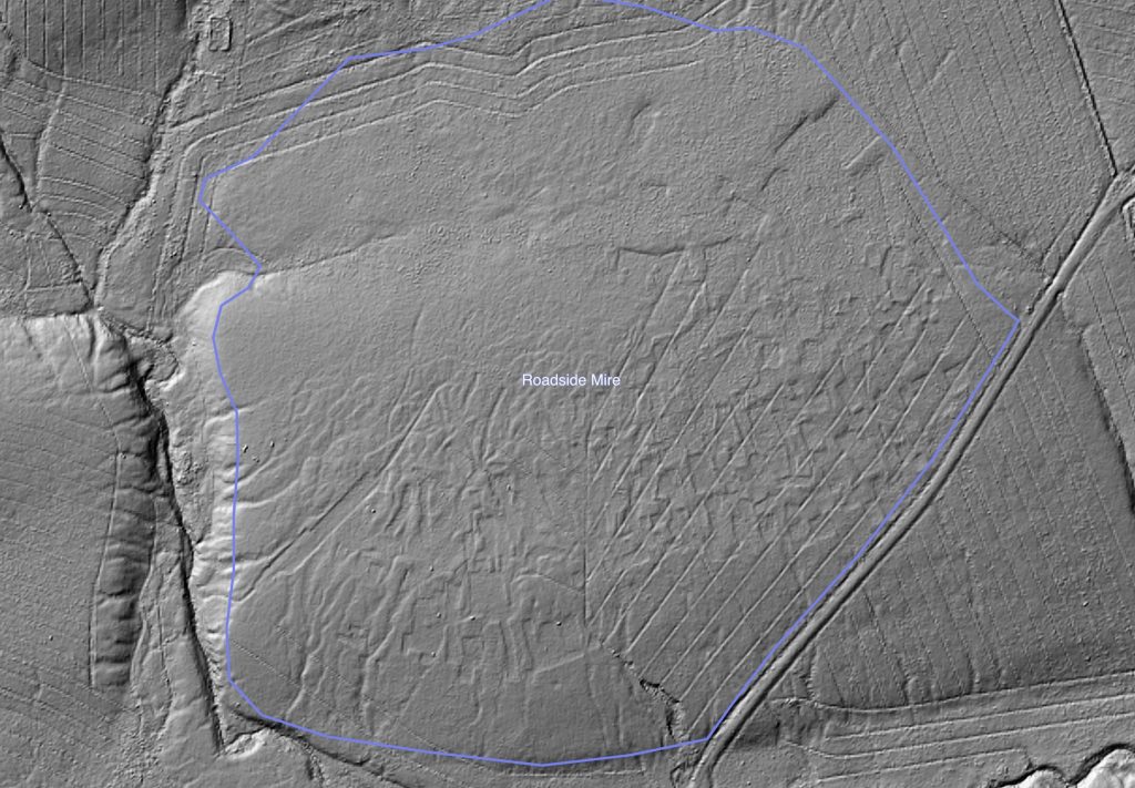
They have utilised LiDAR to great effect in elucidating the environmental history of peat bogs and in particular, anthropogenic influences such as cutting and drainage, using this information to help restore the natural hydrological functioning of Sites of Special Scientific Interest.

2024 roadside mire peat cuttings
LiDAR imagery of rectangular peat pits and drainage ditches cut into blanket bog, Cumbria. Hillshade 45° altitude, 315° azimuth. Contains public sector information licensed under the Open Government Licence v3.0

Statistical analysis and Ecosystem modelling

5

Using exploratory data techniques, Max and Siân have identified significant ecological relationships and have used these to build predictive models incorporating variables such as water levels, invertebrate communities, and bird populations.

image029
Mica schist, Argyll

Geology, Soils and Hydrology

6

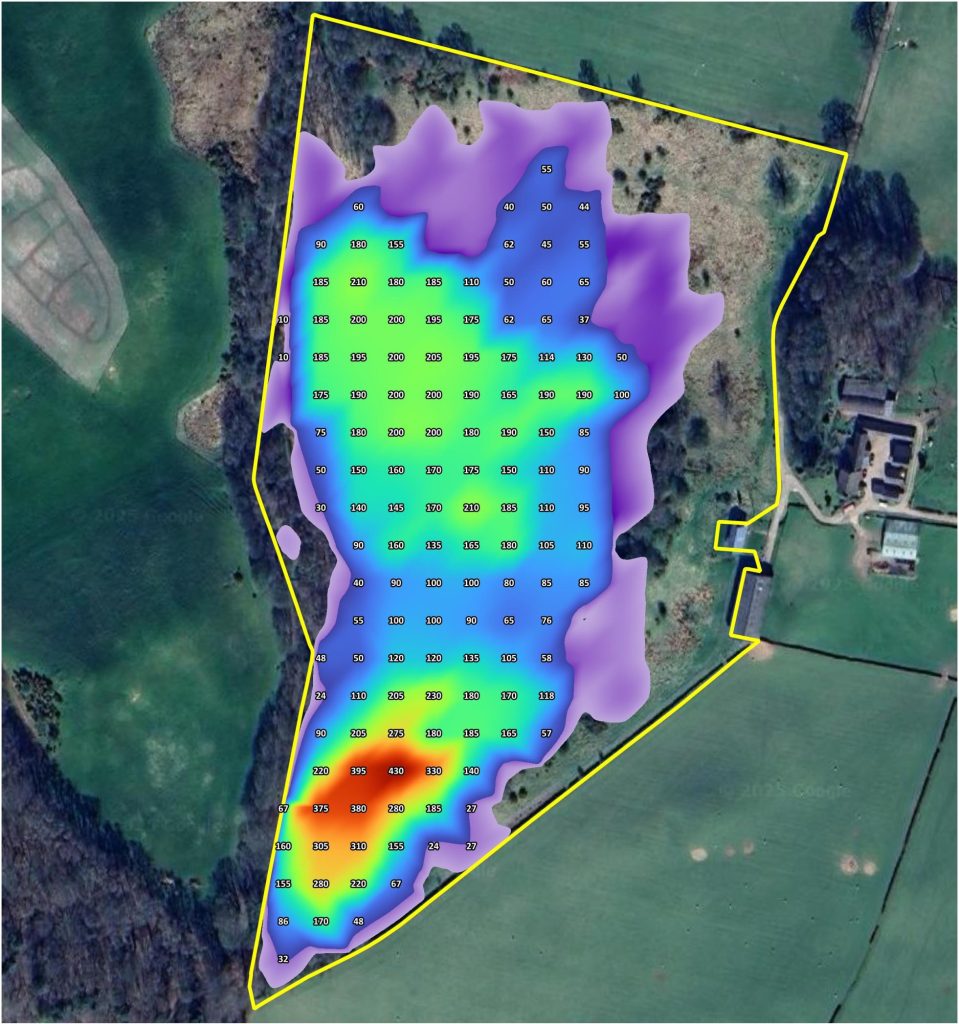
Max and Siân have extensive experience of sampling soils, particularly the soils of fens and peatlands. In addition, they have assessed the hydrological functioning of SSSI landscapes in relation to condition assessments and restoration projects.

peat depth with transitional soils
Peat depth survey of cut-over valley mire, Cumbria. Google imagery ©2025 Airbus, Infoterra Ltd & Bluesky, Maxar Technologies, Map data ©2025

All Photos © Max Carstairs

Scroll to Top